Climate Risk and Migration

Hi there! I'm a geographer and data scientist specializing in geospatial analysis and vizualizations. I have experience in survey design and analysis as well as statistical modeling methods. My research interests include climate risk and adaptation, human migration dynamics, and social inequalities. I currently work as an Earth Scientist at Pacific Northwest National Laboratory focusing on decarbonization pathways and impacts.

Oregon State University, Corvallis
M.S. Geography - -

California Polytechnic State University, San Luis Obispo
B.S. Environmental Management - -
Climate Risk and Migration

CA Climate Risk Perceptions
California Cities Historically Redlined Areas
Curry County Hazard Mitigation
Flood Risk Mapping Case Study
Bangladesh Inundation Mapping
Left: Mock Natural Hazards Mitigation report created for Curry County, Oregon. Report assesses most prevalent regional natural hazards and possible mitigation solutions with integration of spatial design methods to support findings. Right: Comprehensive paper analyzing the history of the National Flood Insurance Program in the United States. Insights using descriptive statistics, Government Accountability Office reports, and academic research.
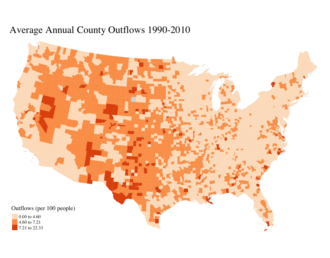
Interactive map created in R Studio using sp and leaflet packages. Figure is the predicted impacts of flooding on county-to-county out-migration based on annual county migration trends and annual county National Flood Insurance claims. Prediction impacts generated from spatial regression model utilizing IRS county-to-county migration data and county-level National Flood Insurance Program claims.

Evergreen Economics
Senior Analyst - -
Perform in-depth research and data analysis to support a variety of client projects including energy program evaluations, metered energy usage comparison, and survey response summarization. Provide integrated static and web-mapping GIS solutions tailored to client needs. Utilize novel and industry-standard statistical modeling approaches to survey analysis and billing impacts.

Sunrun
Interconnection Representative - -
Acted as primary company representative to regional electricial utility clients. Advanced residential solar projects with facilitated project management utilizing Salesforce CRM software. Collaborated across company departments to address project escalations and specifications.
Climate Risk and Migration
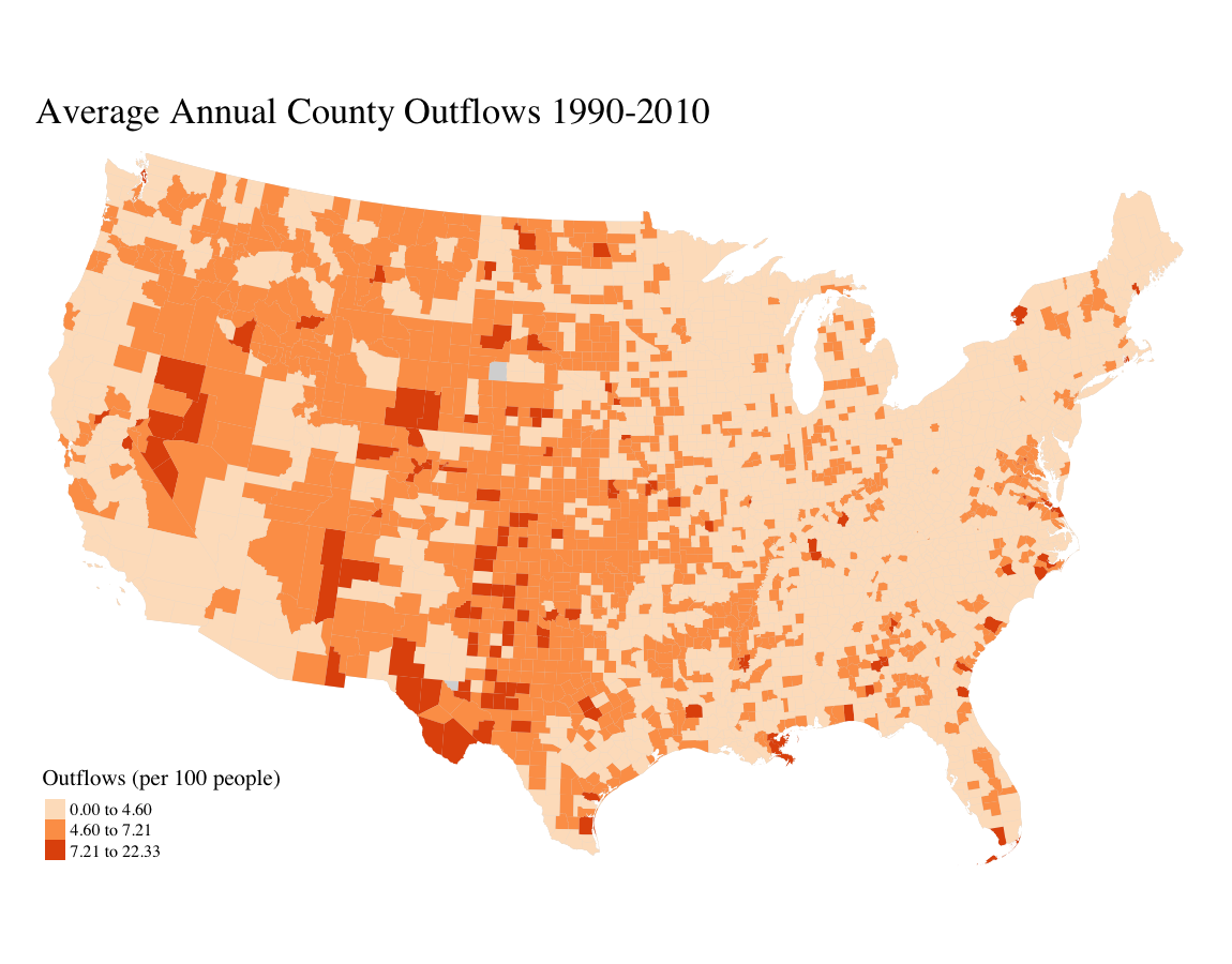
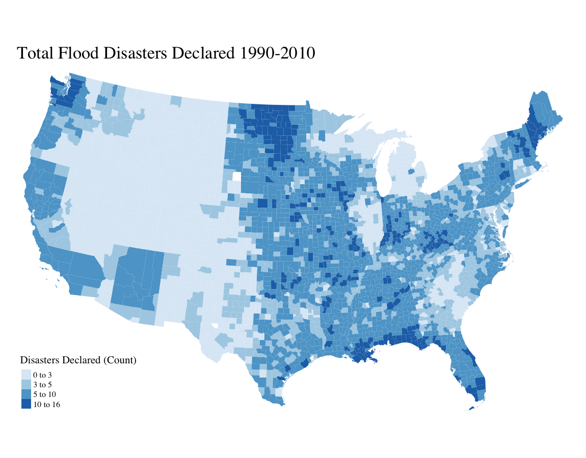
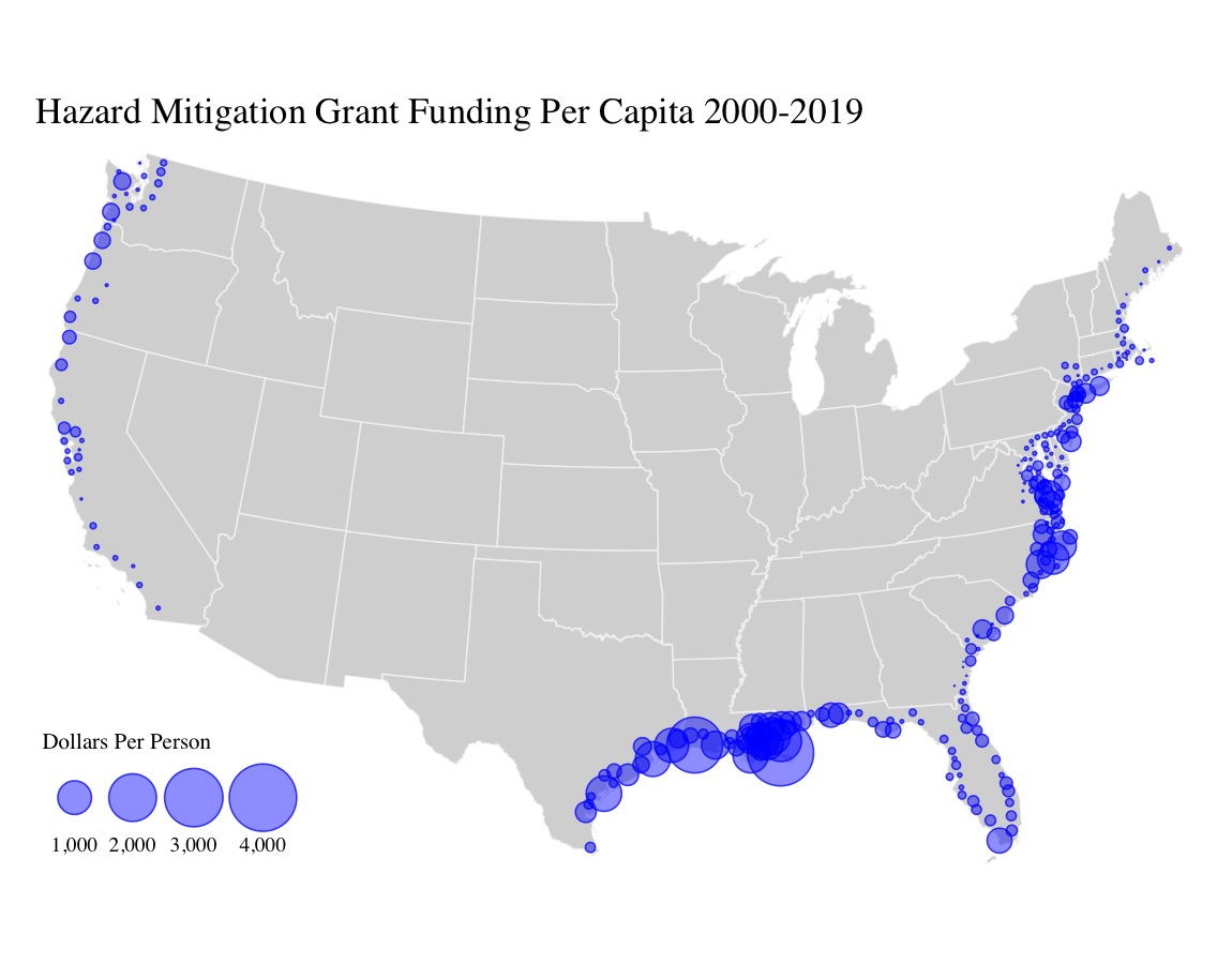
Figures created in part of thesis project analyzing county-to-county migration data, FEMA disaster declarations and coastal hazard mitigation grant funding. Products from this analysis resulted in a robust spatial regression model denoting impacts to county migration outflows.
California Climate Opinions and Exposure
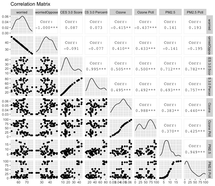
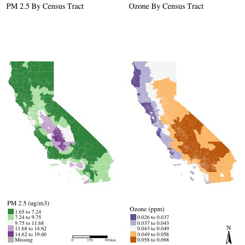
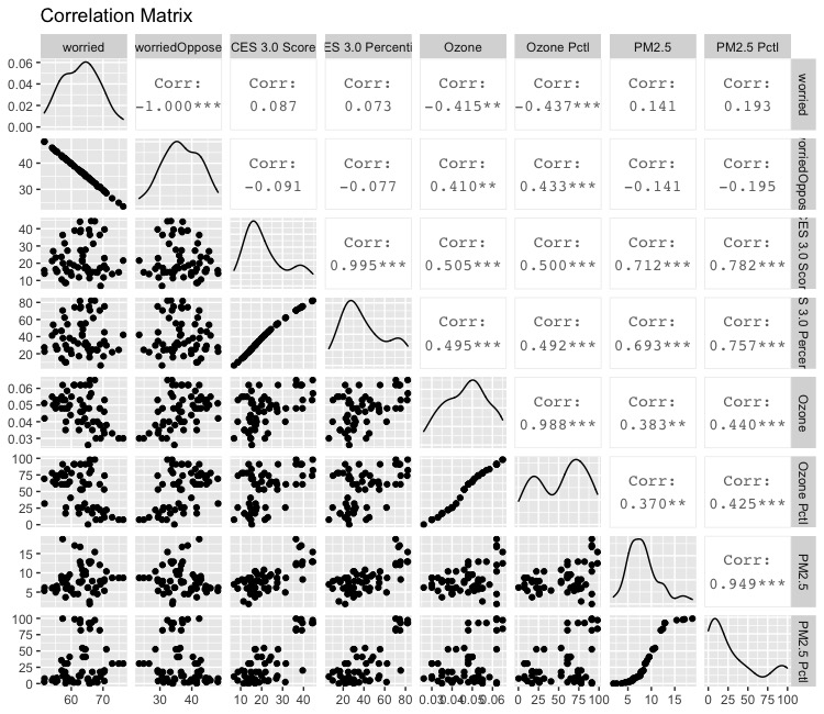
Utilized state environmental datasets with Yale Climate Opinions Survery data to explore spatial correlations between various environmental pollution sources and risk perceptions regarding climate change.
CA Housing Burden and Historically Redlined Areas
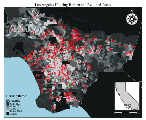
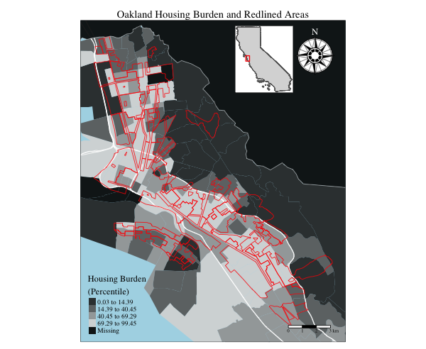
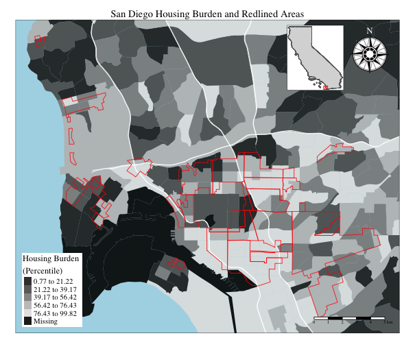
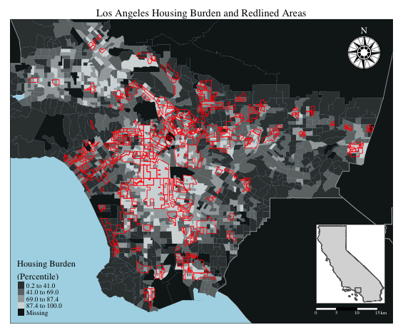
Maps of housing burdened areas (households paying more than 50% of income toward housing) of California Cities by census tract with Homeowner Loan Corporation (HOLC) historically discriminated housing districts (redlines) overlaid.
Hazard Mitigation Geodesign

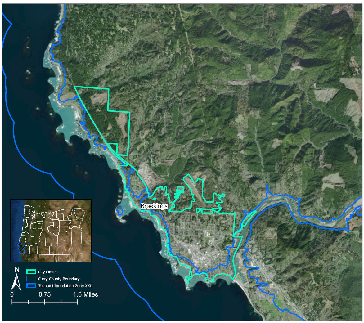
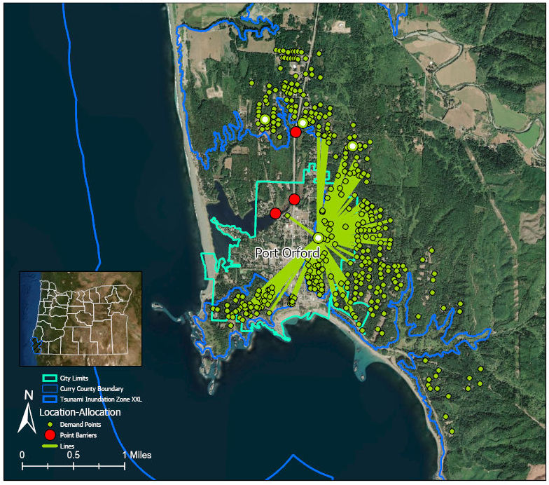
Examples of mapping approaches to supplement natural hazard mitigation report. First figure utilizes network analysis of vacant tax lots to determine suitable locations for emergency response infrastructure to be relocated outside of predicted tsunami inundation zone.
Flood Risk Development Classification

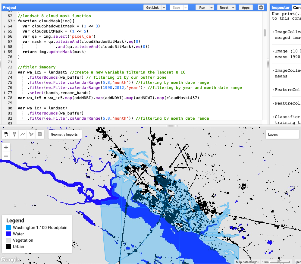
Case study analysis of a town's growth in a FEMA floodplain over a 25 year period. Utilized supervised classification and machine learning algorithms in Google Earth Engine to identify three different land cover classes: water, developments, land.
Bangladesh Inundation Mapping

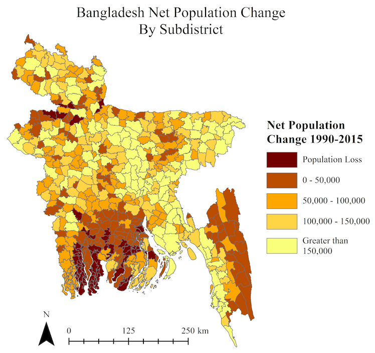
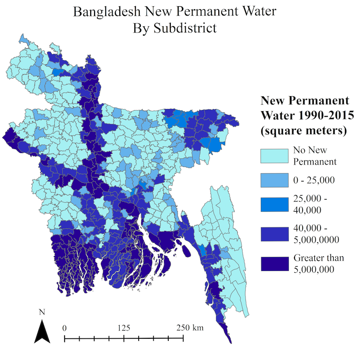
Undergraduate senior project work denoting changes in classification classes of land loss and non-seasonal water presence between 1990 and 2015. Population change also mapped between these 2 epochs.